Community Climate Resilience in Turner Station
COMMUNITY RESOURCES
Evaluating Flooding in Turner Station
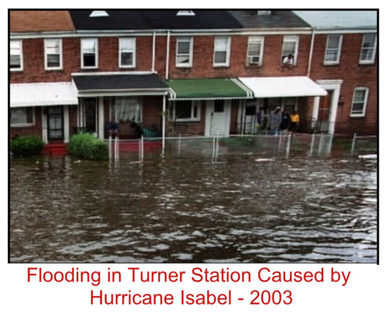
The Community of Turner Station experiences a double threat of flooding due to rainfall and extreme tides because it is situated close to sea level among tributaries to the Chesapeake Bay and downslope from large expanses of urban development. These problems continue to get worse due to sea level rise, increased storm intensity and other effects of climate change.
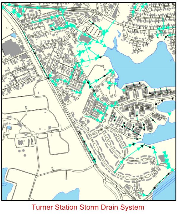
Like many older communities in Baltimore County, Turner Station was founded prior to modern infrastructure. Services such water supply, sanitary sewer, and storm drains were added over time as the population grew, and homes and businesses were built. According to County records, storm drain pipes installed as early as 1952 and older are still in service. Unfortunately, infrastructure that is implemented on an as-needed basis rarely keeps ahead of demands and additional development, and often does not serve the entire community. Additionally, very low terrain and little slope combined with high tides cause storm drain pipes to fill and back up from surrounding waterways, allowing nowhere for precipitation to go. As a result, the storm drain system is inadequate to address rainfall runoff.
Past studies have been conducted to quantify the challenges that residents of Turner Station face and propose measures to mitigate the impact of flooding. Recently, the United States Army Corp of Engineers (USACOE) conducted a study in 2022 and presented its findings to the community. This effort was a valuable starting point, but did not take important information into consideration. Specifically, the 2007[?] construction of the Sollers Point Multi-Purpose Center altered the landscape and drainage paths in the vicinity of Chestnut and Oak Roads, and surrounding properties. This study also identified some extreme engineering design to address flooding, including building levees and large pumps without considering the enormous cost and disruption to the community that this type of infrastructure requires.
To address these deficits, Baltimore County recently requested and received multiple federal grants to perform a comprehensive assessment of conditions within Turner Station, and work with community stakeholders to identify specific problems and measures to reduce flooding. This effort will look at the condition of the storm drain system, existing land features, overland runoff flow paths, tides, and current and future rainfall predictions. Along with this assessment, the County is working with local non-profit groups and community representatives to connect with residents and business owners to learn how they are impacted by flooding, discuss what changes are needed to the storm drain system and land-use practices, and how much disruption and/or changes within their community that they are willing to accept to address flooding issues.
Currently, a survey is being conducted by NeighborSpace of Baltimore County to get information from community members about their experience and concerns regarding flooding in Turner Station; these responses will be incorporated into the County’s assessment. The survey is linked at the top of the page.
The assessment findings will be presented to the community in 2024. In the meantime, Baltimore County, the contractor performing the assessment, partners, and community representatives will conduct a series of outreach initiatives to: get information about the community’s concerns, share ways to reduce risks associated with flooding, and increase awareness about the causes and effects of climate change.
The Community Climate Resilience project is funded by a grant from the National Fish and Wildlife Foundation's Coastal Resilience Fund and is a partnership between Baltimore County government, Turner Station Conservation Teams, NeighborSpace, The Nature Conservancy, Chesapeake Bay Foundation and Greater Baltimore Wilderness Coalition.