Site of Proposed Pocket Park Calls Forth Overlea’s Rich History
One-fifth of America lives in “first-tier” or “inner suburbs” like those inside the URDL in Baltimore County, home to roughly 90 percent of the County’s population. More often than not, you find NeigborSpace railing against their challenges – a pressing lack of open space, uncontrolled stormwater runoff, low walkability, etc.
Fortunately, there is always “a glass-half-full” account of these same locales, featuring the rich history of people and place. These stories are as much a part of the parcels NeighborSpace protects as their trees, shrubs, flowers, and other landscape elements. And it is no small truth that they keep the board and staff going. Here is one such account from a soon-to-be pocket park in the first-tier suburb we all know as Overlea.
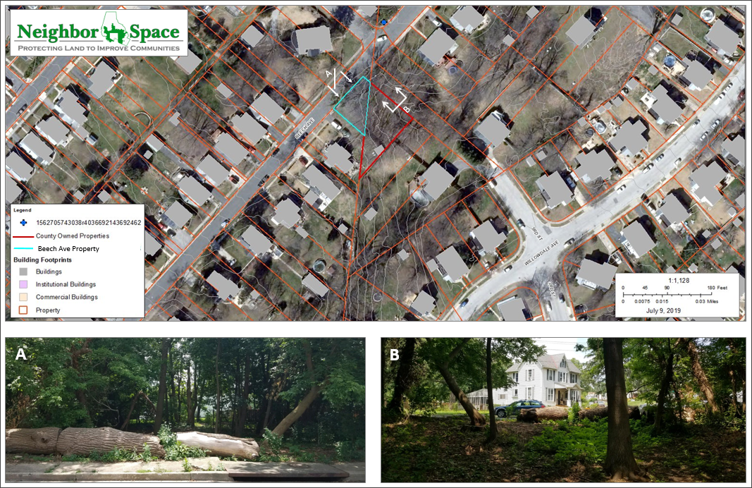
NeighborSpace acquired the site outlined in blue below in 2016, a gift from the family of Helen Miller Hundt. The adjacent parcel, outlined in red, which NeighborSpace is working to annex for the park, is owned by Baltimore County. Redhouse Creek, a tributary of Back River, runs underneath the parcels, having been diverted underground many years ago, according to long-time neighborhood resident, Roger Price.
In their nearly untouched state, the two parcels call forth a time when Overlea was a very different place than it is today. You see, Overlea means “over the meadows” and is a direct reference to the area’s early farming history. Eventually, people who wanted a country setting close to the City and accessible via the Belair Road carline created a market for new subdivisions there. Tree-lined streets with Victorian homes followed and are part of Overlea’s enduring charm today.
A 1911 Sun article, quoted in Eric Holcomb’s book, The City as Suburb, describes the relatively new suburb in this way:
Situated on the high ground just east of Belair Road at the terminus of the car line and overlooking miles of beautiful countryside is Overlea Park. As one enters … by its main thoroughfare, Willow Avenue, he is struck by the beauty and extent of the view afforded. He sees across and beyond the suburb proper and beholds luxuriant cornfields and meadows and woodlands, and circling all, in the distance, a range of hills which lend an almost mountainous touch to the landscape.
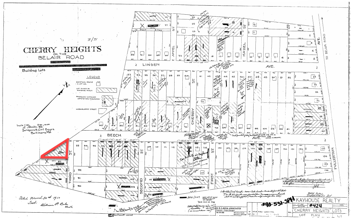
This bucolic scene was short-lived. By 1918 Overlea had fifteen subdivisions, among them a 24-acre track, Cherry Heights, that was one of the first marketed to African Americans. According to historian Louis Diggs, a 1910 newspaper advertisement offered the lots “at reasonable prices and on the most reasonable terms.” He interviewed lifelong Cherry Heights resident Selma M. Jackson prior to her death, who recalled that white and black children would play baseball together and fly kites at nearby Fullerton School. She also lamented that segregation prevented her from being able to attend that same school and destined her to traveling by bus to Dunbar Elementary in the City instead.
A little bit of digging led us to the plat of Cherry Heights from 1910, shown below. It indicates that the County parcel outlined in red above forms part of the subdivision’s southwestern boundary.
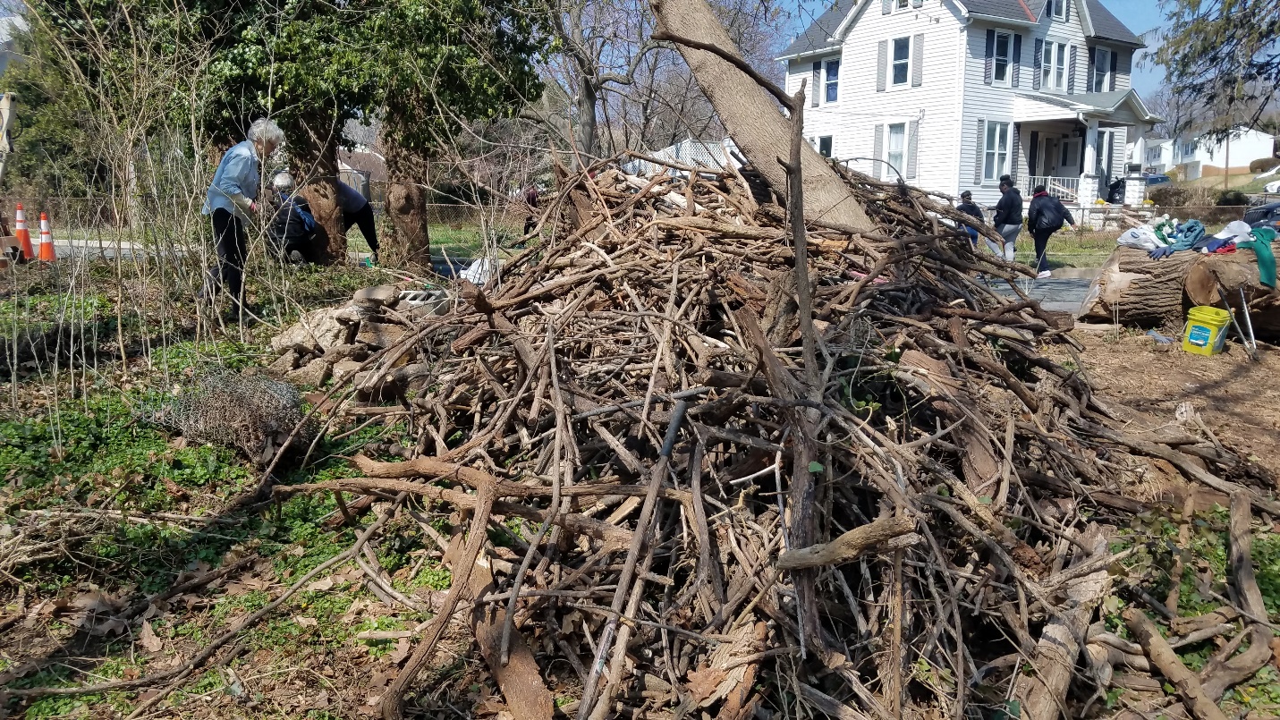
This past spring, NeighborSpace began working with various groups of volunteers to clean up the site in anticipation of creating a pocket park there. From concrete, to toilets, to fallen trees, and golf balls, volunteers, staff, and board members collected and removed an impressive pile of debris over the course of several weekends, as shown in the photo below.
In June, NeighborSpace program manager, Patrick Filbert, attended the monthly meeting of the Overlea Community Association to solicit volunteers for a Steering Committee to create a pocket park on the site. On July 10, Muriel Cruickshank, Caitlin A. Daniels, Kendra Hay, Rebecca Loumiotis, Jennifer Schmidt, Martin Nibali, and Roger Price met with NeighborSpace staff, Barbara Hopkins and Patrick Filbert, at Kenwood Presbyterian Church to discuss goals and constraints for the design of the site.
Among the goals were keeping the natural feel of the site, planting more native overstory and understory trees, and providing space for passive recreation for all ages. The idea of a pollinator garden in the grassy area of the site was discussed as well as bird and bat houses. The group felt that trees should be tagged for educational purposes and the Cherry Heights history conveyed and respected, perhaps with a plaque. They also felt that the big rocks on site should be used to define an informal neighborhood gathering area in the middle of the site.
Concerns raised included discouraging the site’s use as a “cut-through” for pedestrians from Beech Avenue to Willowdale Avenue, keeping the site clean, and slowing traffic to keep pedestrians crossing Beech Avenue safe. The group will meet again in September to discuss design concepts. If you are interested in joining the email list for the project, send your request to shannon@neighborspacebaltimorecounty.org and we will be glad to add you. In addition, you can keep track of what’s happening by visiting the Beech Avenue page on our website at: https://www.neighborspacebaltimorecounty.org/projects/beech-avenue/.
Pingback: History Drives Design of Cherry Heights Woodland Garden - NeighborSpace of Baltimore County
Pingback: Woodland Garden Brings Peace in a Pandemic - NeighborSpace of Baltimore County
Pingback: Watershed Moment for a Woodland Garden - NeighborSpace of Baltimore County